Tengnoupal, nestled in the hills of Manipur, India, is a testament to historical resilience and cultural complexity. Its name, derived from Meitei words meaning "tender cactus fence," hints at a strategic past deeply rooted in defense and survival. During the Manipur-Burmese War in the 16th century, this hill town became a critical battleground where cactus plantings served as natural fortifications against invading forces.
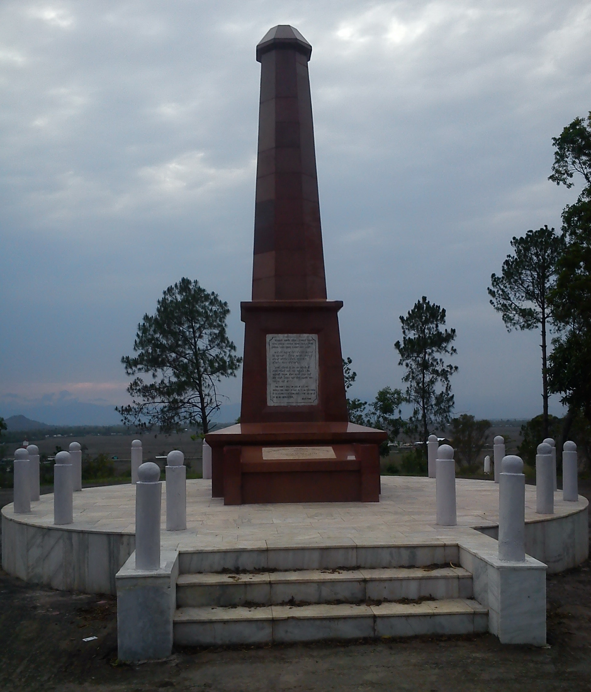
The town's historical narrative is marked by significant conflicts, including the Anglo-Kuki War of the 19th century, where local resistance against British colonial powers was particularly fierce. Under the leadership of Pu Chomsho Mate, more than 30 British personnel were killed, ultimately leading to the British capture and establishment of administrative headquarters in the region. This period underscores Tengnoupal's role as a site of profound resistance and cultural preservation.
World War II further elevated Tengnoupal's strategic importance. The town became a crucial location for the Indian National Army (INA) and Japanese Army, supported by local inhabitants. The British Royal Air Force's bombing of the hill ranges resulted in significant casualties among INA, Japanese, and local volunteers, marking the town as a critical theater of wartime resistance and sacrifice.
Administrative transformations have characterized Tengnoupal's modern history. Initially part of the Manipur Central district, it was carved out and reassigned multiple times, finally becoming Tengnoupal District in 2016. This administrative evolution reflects the complex political landscape of the region, with sub-divisions like Machi, Moreh, and Tengnoupal highlighting its administrative significance.
The town represents a vibrant cultural mosaic, primarily populated by the Kuki people and situated in the linguistically diverse Manipur Hills. Its location on the Imphal-Moreh Highway, part of the ASEAN Highway, makes it a critical transit point for trade and cultural exchanges between India and Myanmar. The region's ethnic diversity is reflected in its linguistic richness, with Tibeto-Burman Manipuri serving as a unifying language.
Contemporary Tengnoupal faces significant challenges, particularly ethnic tensions between Kuki and Meitei communities. These conflicts have created administrative complexities and social fault lines, making governmental operations difficult. Despite these challenges, local leaders and community members continue to work towards peace and reconciliation, embodying the town's historical spirit of resilience.
The landscape of Tengnoupal offers a unique aesthetic experience. Positioned at the highest point of the Imphal-Moreh Highway, it provides breathtaking views of surrounding hills and the Kabaw Valley in Myanmar. During monsoon and summer months, the town attracts visitors with its foggy weather and cool winds, offering a picturesque retreat that blends natural beauty with rich historical significance.
As an administrative center, Tengnoupal continues to play a crucial role in the region's governance. The Deputy Commissioner's office and District Hospital stand as symbols of administrative infrastructure. Yet, beyond bureaucratic functions, the town remains a powerful narrative of cultural preservation, historical resistance, and ongoing efforts to maintain social harmony in a complex, multi-ethnic landscape.